Fail:Sea Gate aerial view.jpg
Selle eelvaate suurus: 800 × 534 pikslit. Teised eraldusvõimed: 320 × 214 pikslit | 640 × 428 pikslit | 1024 × 684 pikslit | 1500 × 1002 pikslit.
Algfail (1500 × 1002 pikslit, faili suurus: 657 KB, MIME tüüp: image/jpeg)
| See fail ja sellest kastist allapoole jääv kirjeldus pärinevad kesksest failivaramust Wikimedia Commons. | Faili lehekülg Commonsis |
| Kirjeldus |
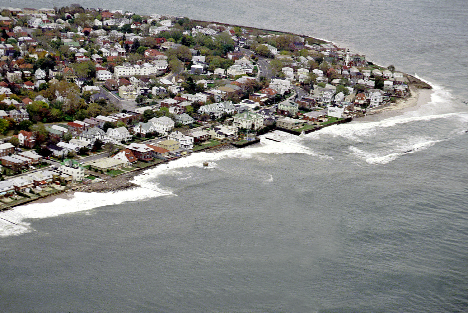
English: Aerial view of the Sea Gate community located on the westernmost extremity of Coney Island, Brooklyn, New York City. |
|||
| Kuupäev | ||||
| Allikas |
U.S. Army Corps of Engineers Digital Visual Library Image page Image description page Digital Visual Library home page |
|||
| Autor | U.S. Army Corps of Engineers, photographer not specified or unknown | |||
| Luba (Faili edasikasutus) |
|
|||
| Asukoht | Brooklyn, New York City, New York, USA |
| Objekti asukoht | | See ja teised pildid sellest paigast lehel: OpenStreetMap |
|---|
Faili ajalugu
Klõpsa kuupäeva ja kellaaega, et näha sel ajahetkel kasutusel olnud failiversiooni.
| Kuupäev/kellaaeg | Pisipilt | Mõõtmed | Kasutaja | Kommentaar | |
|---|---|---|---|---|---|
| viimane | 9. aprill 2007, kell 08:01 | | 1500 × 1002 (657 KB) | DanMS | {{Information | Description = {{en|Aerial view of the Sea Gate community located on the westernmost extremity of Coney Island, Brooklyn, New York City.}} | Source = U.S. Army Corps of Engineers Digital Visual Library<br />[http://images.usace.a |
Faili kasutus
Seda faili kasutab järgmine lehekülg:
Globaalne failikasutus
Järgmised muud vikid kasutavad seda faili:
- Faili kasutus vikis de.wikipedia.org
- Faili kasutus vikis en.wikipedia.org
- Faili kasutus vikis es.wikipedia.org
- Faili kasutus vikis he.wikipedia.org
- Faili kasutus vikis ja.wikipedia.org
- Faili kasutus vikis pt.wikipedia.org
- Faili kasutus vikis sv.wikipedia.org
- Faili kasutus vikis vi.wikipedia.org
- Faili kasutus vikis www.wikidata.org
- Faili kasutus vikis yi.wikipedia.org