Fail:Herat.png
Selle eelvaate suurus: 800 × 527 pikslit. Teised eraldusvõimed: 320 × 211 pikslit | 640 × 422 pikslit | 992 × 654 pikslit.
Algfail (992 × 654 pikslit, faili suurus: 1,32 MB, MIME tüüp: image/png)
| See fail ja sellest kastist allapoole jääv kirjeldus pärinevad kesksest failivaramust Wikimedia Commons. | Faili lehekülg Commonsis |
Lühikirjeldus
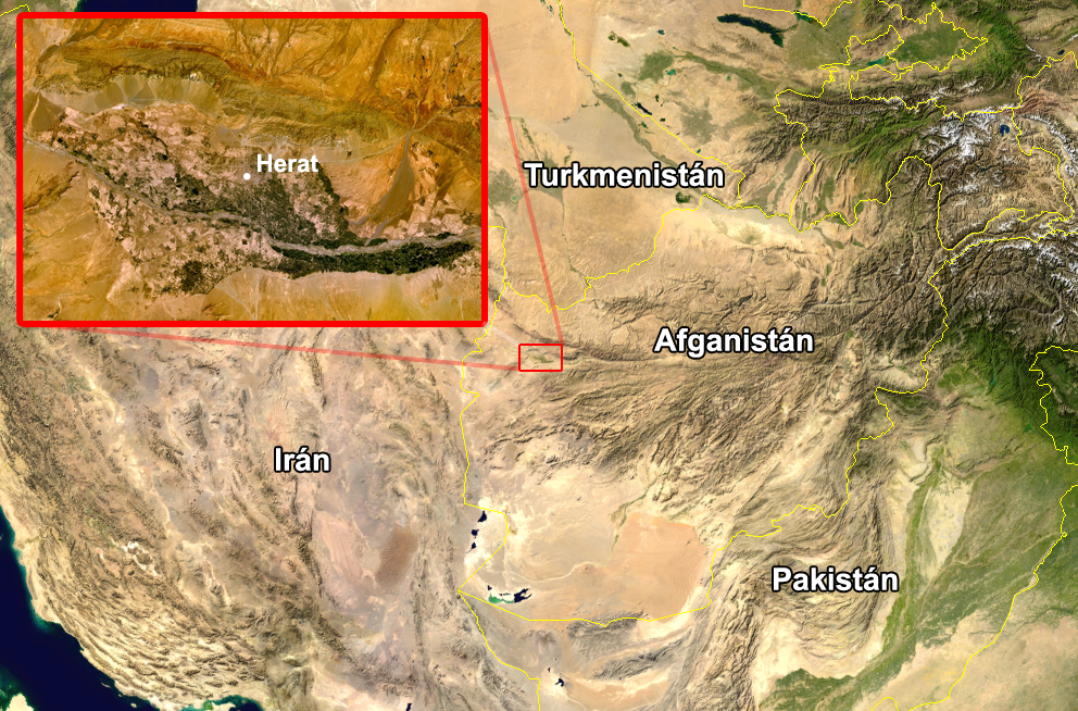
Español: Zona donde se produjo el accidente.
Edited image from two screenshots taken from NASA World Wind of Afghanistan, showing the city of Herat.
| This image is in the public domain because it is a screenshot from NASA’s globe software World Wind using a public domain layer, such as Blue Marble, MODIS, Landsat, SRTM, USGS or GLOBE.
|
 |
Faili ajalugu
Klõpsa kuupäeva ja kellaaega, et näha sel ajahetkel kasutusel olnud failiversiooni.
| Kuupäev/kellaaeg | Pisipilt | Mõõtmed | Kasutaja | Kommentaar | |
|---|---|---|---|---|---|
| viimane | 16. august 2005, kell 16:32 | | 992 × 654 (1,32 MB) | JMPerez~commonswiki | Edited image from two screenshots taken from NASA World Wind of Afghanistan, showing the city of Herat. {{PD-USGov-NASA}} Category:Afghanistan Category:Satellite photos |
Faili kasutus
Seda faili ei kasuta ükski lehekülg.
Globaalne failikasutus
Järgmised muud vikid kasutavad seda faili:
- Faili kasutus vikis es.wikipedia.org
- Faili kasutus vikis es.wikinews.org
- Faili kasutus vikis it.wikinews.org
- Faili kasutus vikis ja.wikinews.org