Fail:Wales in the UK and Europe.svg

Selle SVG-faili PNG-vormingus eelvaate suurus: 713 × 600 pikslit. Teised eraldusvõimed: 285 × 240 pikslit | 571 × 480 pikslit | 913 × 768 pikslit | 1218 × 1024 pikslit | 2435 × 2048 pikslit | 2045 × 1720 pikslit.
Algfail (SVG-fail, algsuurus 2045 × 1720 pikslit, faili suurus: 7,84 MB)
| See fail ja sellest kastist allapoole jääv kirjeldus pärinevad kesksest failivaramust Wikimedia Commons. | Faili lehekülg Commonsis |
Lühikirjeldus
| Kirjeldus |
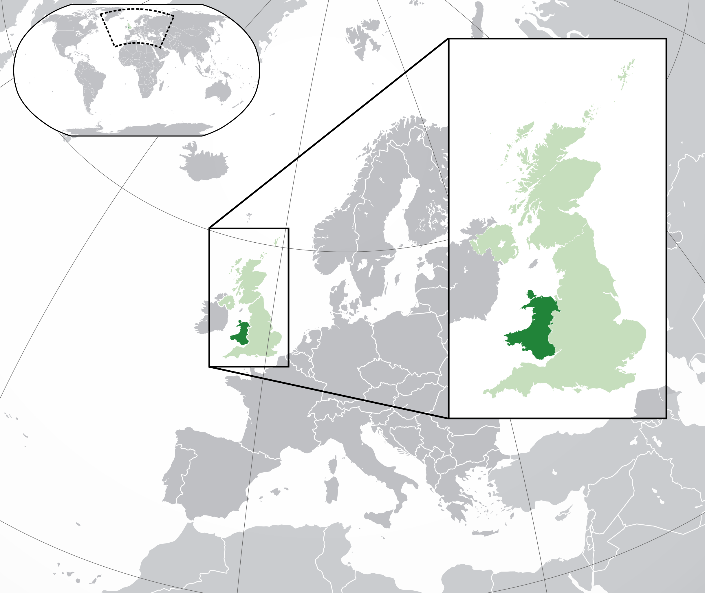
English: A map of Wales within the United Kingdom and Europe. The map is a polar orthographic projection.
Wales
United Kingdom (except Wales)
Europe (except UK) Français : Une carte du Pays de Galles au sein du Royaume-Uni et en Europe. La carte est un polair projection orthographique.
Pays de Galles
Royaume-Uni (sauf le Pays de Galles)
Europe (sauf le Royaume-Uni) Deutsch: Eine Karte der Wales drinnen das Vereinigtes Königreich und drinnen Europa. Die Karte ist ein polare orthografische Azimutalprojektion.
Wales
Vereinigtes Königreich (außer Wales)
Europa (außer das Vereinigtes Königreich) Cymraeg:
Cymru
Y Deyrnas Unedig
Ewrop Gàidhlig:
A' Chuimrigh
An Rìoghachd Aonaichte
An Roinn-Eòrpa Gaeilge:
An Bhreatain Bheag
An Ríocht Aontaithe
An Eoraip Kernowek: Kembra
Ruwvaneth Unys
Europa |
| Kuupäev | (UTC) |
| Allikas |
See fail on tuletatud järgmisest teosest: Blank map of Europe (with disputed regions).svg: |
| Autor |
|
| Teised versioonid |
|
| SVG genesis | See suur vektorkujutis on valmistatud rakendusega Inkscape, or with something else. |


.svg)
Litsents
See fail kuulub jurisdiktsiooniga sidumata Creative Commonsi litsentsi "Autorile viitamine + jagamine samadel tingimustel 3.0" alla.
- Tohid:
- jagada – teost kopeerida, levitada ja edastada
- kohandada – valmistada muudetud teoseid
- Järgmistel tingimustel:
- omistamine – Pead materjali sobival viisil autorile omistama, tooma ära litsentsi lingi ja märkima ära, kas on tehtud muudatusi. Sobib, kui teed seda mõistlikul viisil, kuid seejuures ei tohi jääda muljet, et litsentsiandja tõstab esile sind või seda, et sina materjali kasutad.
- sarnaselt jagamine – Kui töötled, kujundad ümber või arendad materjali edasi, siis pead oma töö levitamiseks kasutama sama litsentsi, mille all on algupärand, või ühilduvat litsentsi.
Esialgne üleslaadimislogi
This image is a derivative work of the following images:
- File:Blank_map_of_Europe.svg licensed with Cc-by-sa-2.5
- 2012-02-21T16:27:27Z Alphathon 680x520 (614699 Bytes) Updated Metadata and the boarders/coastlines along the western coast of the Black Sea
- 2011-09-19T22:57:58Z Alphathon 680x520 (603759 Bytes) Added North/Northern Cyprus
- 2011-08-23T10:26:48Z Heb 680x520 (604212 Bytes) Added [[:en:Bornholm]] (taken from [[:File:Denmark blank map.svg]])
- 2011-04-12T00:40:40Z Alphathon 680x520 (602549 Bytes) Upgraded Sicily based on "File:Freeworldmaps-sicily.jpg". Upgraded Malta based on "File:Map of Malta 2.png". Simplified Croatian borders.
- 2011-04-10T21:43:04Z Alphathon 680x520 (607359 Bytes) Upgraded Croatia, Bosnia & Herzegovina, Slovenia and surrounding countries based on data from "File:Kroatien - Politische Gliederung (Karte).png"
- 2011-04-10T20:05:09Z Alphathon 680x520 (568373 Bytes) Improved Serbia, Montenegro and surrounding countries using data from "File:Serbia Map.png". Fixed Serbia-Montenegro border. Added Kosovo (using dashed border, since it is not a universally recognised nation, and left the lan
- 2011-04-10T15:55:02Z Alphathon 680x520 (524980 Bytes) Tweaked Ukraine and surrounding countries based on data from "File:Up-map.png"
- 2011-04-10T04:02:09Z Alphathon 680x520 (511168 Bytes) Improved Greece, Albania, F.Y.R. Macedonia and Bulgaria based on "File:Greece topo.jpg"
- 2011-04-10T02:48:52Z Alphathon 680x520 (505569 Bytes) Tweaked Germany and surrounding countries based on info from "File:Germany_general_map.png"
- 2011-04-10T01:54:05Z Alphathon 680x520 (493733 Bytes) Converted all lakes back to separate layer. Added Finish lakes and tweaked Finland shape based on "File:Finland 1996 CIA map.jpg". Added Swiss lakes based on "File:Suisse cantons.svg". Tweaked Scotland and added Lochs.
- 2011-04-10T00:07:54Z Alphathon 680x520 (450120 Bytes) Improved England outline and added Isle of Wight based on "File:England Regions - Blank.svg". Improved Denmark based on "File:2 digit postcode danmark.png". Improved Sweden based on "File:Map of Sweden, CIA, 1996.jpg"
- 2011-04-08T15:53:07Z Alphathon 680x520 (438878 Bytes) Upgraded/fixed various parts of the map. Details: *Some minor fixes to Ireland and added some of the larger lakes based on [[:File:Ireland_trad_counties_named.svg]] *Pretty major fixes to Scotland (mainly the west coast and i
- 2008-09-17T09:50:25Z F7 680x520 (531491 Bytes)
- 2008-09-17T09:42:57Z F7 680x520 (2353 Bytes)
- 2008-05-26T19:04:07Z Collard 680x520 (531491 Bytes) uploading on behalf of [[User:Checkit]], direct complaints to him plox: 'Moved countries out of the "outlines" group, removed "outlines" style class, remove separate style information for Russia'
- 2008-04-30T01:38:52Z TimothyBourke 680x520 (531767 Bytes) Changed the country code of Serbia to RS per [http://en.wikipedia.org/wiki/Serbian_country_codes] and the file [http://www.iso.org/iso/iso3166_en_code_lists.txt].
- 2008-02-08T22:44:37Z CarolSpears 680x520 (531767 Bytes) validated
- 2007-07-10T11:47:59Z MrWeeble 680x520 (533112 Bytes) Updated to include British Crown Dependencies as seperate entities and regroup them as "British Islands", with some simplifications to the XML and CSS
- 2007-05-14T17:17:34Z Zirland 680x520 (540659 Bytes) serbia and montenegro
- 2007-03-30T20:40:49Z W!B: 680x520 (538830 Bytes) minor corr: update nl:Ijsselmeer, del fi:lakes (all small), add ru:lake Oneka (all ref maps.google), glued northern irland back to ie ;)
- 2007-02-05T18:44:32Z Maix 680x520 (538295 Bytes) cropped
- 2007-02-04T15:07:29Z Maix 680x520 (538310 Bytes) {{Information |Description=A blank Map of Europe in SVG format. Every country has an id which is its ISO-3116-1-ALPHA2 code in lower case for easy coloring. |Source=Image based on [[Image:Europe_countries.svg|]] by [[User:Ti
Uploaded with derivativeFX
Faili ajalugu
Klõpsa kuupäeva ja kellaaega, et näha sel ajahetkel kasutusel olnud failiversiooni.
| Kuupäev/kellaaeg | Pisipilt | Mõõtmed | Kasutaja | Kommentaar | |
|---|---|---|---|---|---|
| viimane | 6. august 2014, kell 23:00 | | 2045 × 1720 (7,84 MB) | Rob984 | Improved version: More accurate coastline, borders, etc. Added Gradient and Longitude and latitude lines. Zoom insert centred on UK. |
| 21. veebruar 2014, kell 17:58 |  | 680 × 520 (2,48 MB) | Rob984 | White background so that the edge of the map is clear. Consistency with other European countries' maps also. | |
| 19. jaanuar 2013, kell 21:35 |  | 680 × 520 (2,46 MB) | Alphathon | Added Robinson projection to the top left corner. | |
| 27. veebruar 2012, kell 02:37 |  | 680 × 520 (941 KB) | Alphathon | Fixed XML | |
| 27. veebruar 2012, kell 02:35 |  | 680 × 520 (941 KB) | Alphathon | More detailed British Isles | |
| 26. veebruar 2012, kell 03:35 |  | 680 × 520 (790 KB) | Alphathon | Added missing parts of Belgium and the Netherlands. | |
| 26. veebruar 2012, kell 01:36 |  | 680 × 520 (806 KB) | Alphathon | == {{int:filedesc}} == {{Information |Description={{en|A map of Wales (dark green) within the United Kingdom (dark and light green) and Europe (dark green, light green and darker grey).}} |Source={{Derived from|Blank_map_of_Europe.svg|display=50}} |Dat... |
Faili kasutus
Seda faili kasutab järgmine lehekülg:
Globaalne failikasutus
Järgmised muud vikid kasutavad seda faili:
- Faili kasutus vikis af.wikipedia.org
- Faili kasutus vikis af.wiktionary.org
- Faili kasutus vikis am.wikipedia.org
- Faili kasutus vikis ar.wikipedia.org
- Faili kasutus vikis arz.wikipedia.org
- Faili kasutus vikis be.wikipedia.org
- Faili kasutus vikis bg.wikipedia.org
- Faili kasutus vikis bh.wikipedia.org
- Faili kasutus vikis blk.wikipedia.org
- Faili kasutus vikis bs.wikipedia.org
- Faili kasutus vikis bxr.wikipedia.org
- Faili kasutus vikis cdo.wikipedia.org
- Faili kasutus vikis chy.wikipedia.org
- Faili kasutus vikis ckb.wikipedia.org
- Faili kasutus vikis csb.wikipedia.org
- Faili kasutus vikis el.wikipedia.org
- Faili kasutus vikis en.wikipedia.org
- Faili kasutus vikis en.wikinews.org
- Faili kasutus vikis en.wiktionary.org
- Faili kasutus vikis es.wikipedia.org
- Faili kasutus vikis eu.wikipedia.org
- Faili kasutus vikis fa.wikipedia.org
- Faili kasutus vikis fiu-vro.wikipedia.org
- Faili kasutus vikis fi.wikipedia.org
- Faili kasutus vikis fi.wiktionary.org
- Faili kasutus vikis fr.wikipedia.org
- Faili kasutus vikis fy.wikipedia.org
- Faili kasutus vikis gd.wiktionary.org
- Faili kasutus vikis gn.wikipedia.org
- Faili kasutus vikis gu.wikipedia.org
- Faili kasutus vikis hak.wikipedia.org
- Faili kasutus vikis he.wikivoyage.org
- Faili kasutus vikis hi.wikipedia.org
- Faili kasutus vikis hr.wikipedia.org
- Faili kasutus vikis hr.wiktionary.org
- Faili kasutus vikis hu.wikipedia.org
- Faili kasutus vikis hy.wikipedia.org
- Faili kasutus vikis ia.wikipedia.org
- Faili kasutus vikis ilo.wikipedia.org
- Faili kasutus vikis incubator.wikimedia.org
Vaata selle faili globaalset kasutust.