Fail:Sonoma Lake aerial view.jpg
Selle eelvaate suurus: 800 × 534 pikslit. Teised eraldusvõimed: 320 × 214 pikslit | 640 × 427 pikslit | 1024 × 683 pikslit | 1500 × 1001 pikslit.
Algfail (1500 × 1001 pikslit, faili suurus: 542 KB, MIME tüüp: image/jpeg)
| See fail ja sellest kastist allapoole jääv kirjeldus pärinevad kesksest failivaramust Wikimedia Commons. | Faili lehekülg Commonsis |
| Kirjeldus |
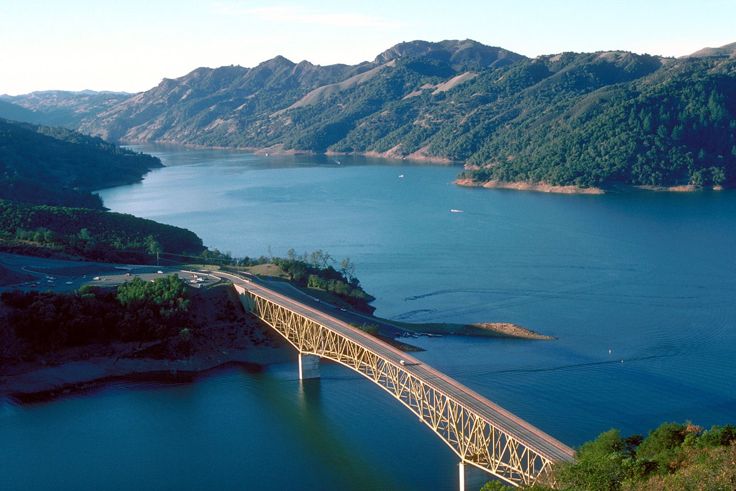
English: Aerial view of Lake Sonoma on Dry Creek in Sonoma County, California, USA. The lake is impounded by Warm Springs Dam, constructed in 1983 by the U.S. Army Corps of Engineers for flood control and water supply. The dam is just off to the right and is not visible in this picture. View is to the northwest.
Coordinates: 38°43′8.04″N 123°0′47.62″W / 38.7189°N 123.0132278°W |
|||
| Asukoht | Sonoma County, California, USA | |||
| Kuupäev | not specified or unknown | |||
| Allikas |
U.S. Army Corps of Engineers Digital Visual Library Image page Image description page Digital Visual Library home page |
|||
| Autor | U.S. Army Corps of Engineers, photographer not specified or unknown | |||
| Luba (Faili edasikasutus) |
|
|||
| Teised versioonid |
|

Faili ajalugu
Klõpsa kuupäeva ja kellaaega, et näha sel ajahetkel kasutusel olnud failiversiooni.
| Kuupäev/kellaaeg | Pisipilt | Mõõtmed | Kasutaja | Kommentaar | |
|---|---|---|---|---|---|
| viimane | 4. mai 2007, kell 06:32 | | 1500 × 1001 (542 KB) | DanMS | {{Information | Description = {{en|Aerial view of Lake Sonoma on Dry Creek in Sonoma County, California, USA. The lake is impounded by Warm Springs Dam, constructed in 1983 by the U.S. Army Corps of Engineers for flood control and water supply. The dam |
Faili kasutus
Seda faili kasutab järgmine lehekülg:
Globaalne failikasutus
Järgmised muud vikid kasutavad seda faili:
- Faili kasutus vikis de.wikipedia.org
- Faili kasutus vikis en.wikipedia.org
- Faili kasutus vikis es.wikipedia.org
- Faili kasutus vikis fr.wikipedia.org
- Faili kasutus vikis sk.wikipedia.org
- Faili kasutus vikis www.wikidata.org