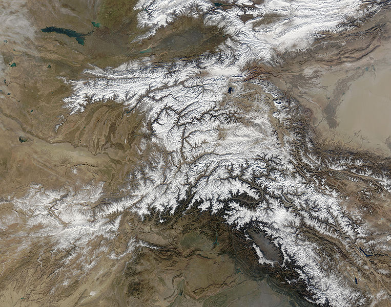
Fail:Hindu Kush satellite image.jpg

Selle eelvaate suurus: 763 × 600 pikslit. Teised eraldusvõimed: 306 × 240 pikslit | 611 × 480 pikslit | 978 × 768 pikslit | 1280 × 1006 pikslit | 2560 × 2011 pikslit | 5600 × 4400 pikslit.
Algfail (5600 × 4400 pikslit, faili suurus: 5,01 MB, MIME tüüp: image/jpeg)
Faili ajalugu
Klõpsa kuupäeva ja kellaaega, et näha sel ajahetkel kasutusel olnud failiversiooni.
| Kuupäev/kellaaeg | Pisipilt | Mõõtmed | Kasutaja | Kommentaar | |
|---|---|---|---|---|---|
| viimane | 6. juuni 2006, kell 07:39 |  | 5600 × 4400 (5,01 MB) | Avenue | {{Information |Description=The Hindu Kush occupies the lower-left-center of this true-color MODIS satellite image, acquired 28 November 2003. |Source=[NASA's Earth Observatory http://earthobservatory.nasa.gov/Newsroom/NewImages/images.php3?img_id=16411] | |
Faili kasutus
Seda faili kasutab järgmine lehekülg:
Globaalne failikasutus
Järgmised muud vikid kasutavad seda faili:
- Faili kasutus vikis bcl.wikipedia.org
- Faili kasutus vikis bn.wikipedia.org
- Faili kasutus vikis ca.wikipedia.org
- Faili kasutus vikis el.wikipedia.org
- Faili kasutus vikis en.wikipedia.org
- Faili kasutus vikis es.wikipedia.org
- Faili kasutus vikis eu.wikipedia.org
- Faili kasutus vikis fa.wikipedia.org
- Faili kasutus vikis fi.wikipedia.org
- Faili kasutus vikis it.wikipedia.org
- Faili kasutus vikis mk.wikipedia.org
- Faili kasutus vikis ml.wikipedia.org
- Faili kasutus vikis mr.wikipedia.org
- Faili kasutus vikis nl.wikipedia.org
- Faili kasutus vikis nn.wikipedia.org
- Faili kasutus vikis pa.wikipedia.org
- Faili kasutus vikis pl.wikipedia.org
- Faili kasutus vikis pnb.wikipedia.org
- Faili kasutus vikis pt.wikipedia.org
- Faili kasutus vikis ro.wikipedia.org
- Faili kasutus vikis sk.wikipedia.org
- Faili kasutus vikis sl.wikipedia.org
- Faili kasutus vikis sr.wikipedia.org
- Faili kasutus vikis ta.wikipedia.org
- Faili kasutus vikis tg.wikipedia.org
- Faili kasutus vikis th.wikipedia.org
- Faili kasutus vikis uz.wikipedia.org
- Faili kasutus vikis vi.wikipedia.org

