Fail:US Navy 030411-N-0000X-001 A detailed multibeam image for the survey of USS Susan B. Anthony (AP-72).jpg

Selle eelvaate suurus: 800 × 598 pikslit. Teised eraldusvõimed: 320 × 239 pikslit | 640 × 478 pikslit | 1024 × 765 pikslit | 1280 × 956 pikslit | 2104 × 1572 pikslit.
Algfail (2104 × 1572 pikslit, faili suurus: 2,21 MB, MIME tüüp: image/jpeg)
| See fail ja sellest kastist allapoole jääv kirjeldus pärinevad kesksest failivaramust Wikimedia Commons. | Faili lehekülg Commonsis |
Lühikirjeldus
| Kirjeldus |
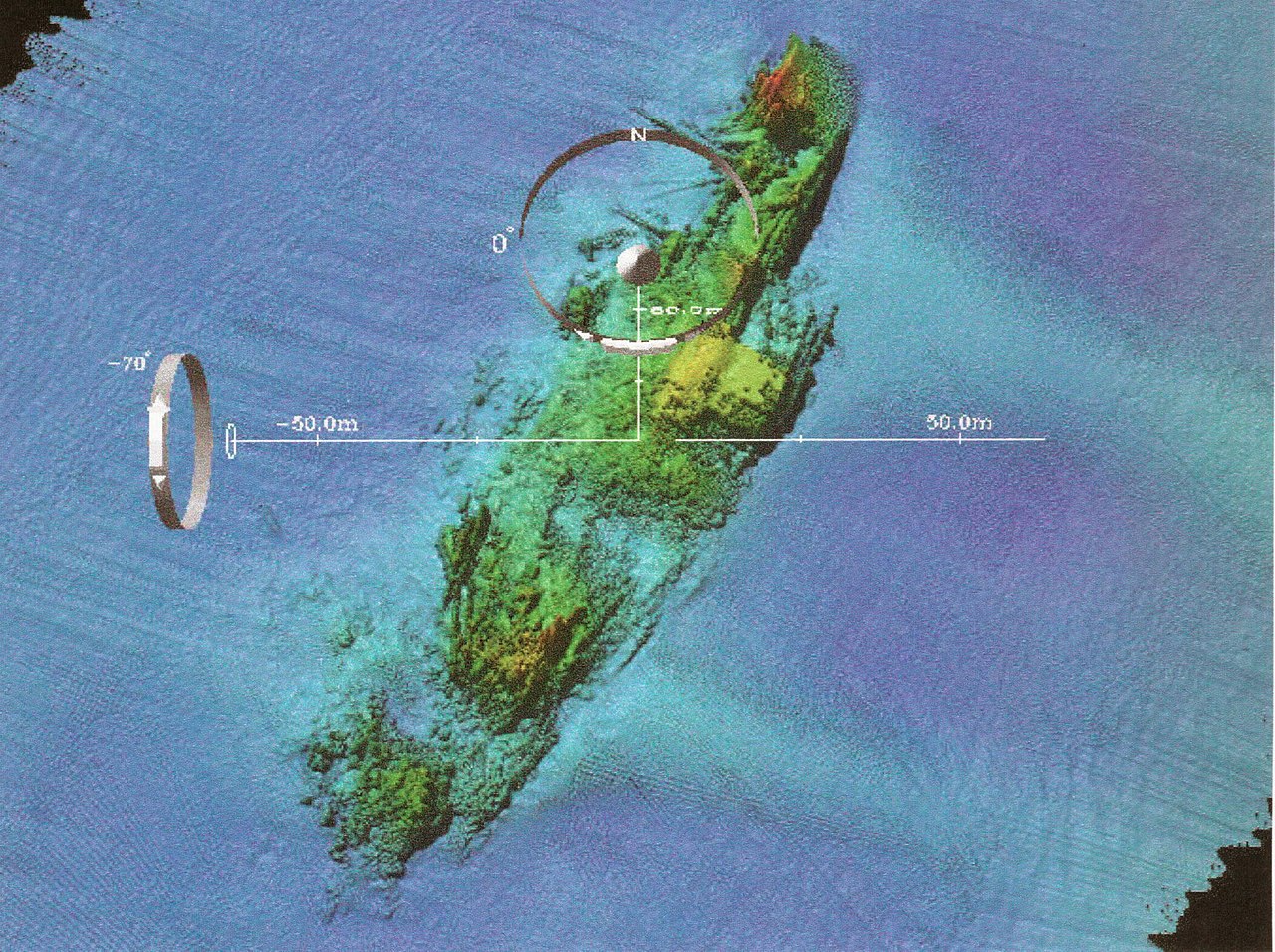
English: Naval Historical Center archeologists have just completed a three-year (2000-200) archeological remote-sensing survey of U.S. Navy shipwreck lost off France’s coastline during the World War II Normandy invasion. The survey focused on locating Navy losses and the temporary harbors used in Neptune, the naval portion of Operation Overlord, codename for the Allied invasion of Europe, (D-Day), June 6, 1944. Cooperative effort between the Naval Historical Center, RESON (an off shore technology company), FUGRO (a company that makes navigation products), and the Center for Coastal and Ocean Mapping and Joint Hydrographic Center (CCOM) produced very detailed multibeam images for the survey such as this overview of the USS Susan B. Anthony (AP-72). The Susan B. Anthony, a troop transport, struck a sea-mine and san on June 7, 1944. The booms and damage to the number one hole (at the bow) are easy to see in this image. U. S. Navy photo. |
|||
| Kuupäev | Pildistamisaeg 11. aprill 2003 | |||
| Allikas |
|
|||
| Autor | U.S. Navy photo |

.jpg?uselang=et)
Litsents
See pilt on Ühendriikide mereväe teenistuja või mereväelase tehtud ametikohustuste täitmise ajal. Ameerika Ühendriikide keskvalitsuse teosena kuulub see teos avalikku omandisse.
|
 | |
| Seda faili peetakse autoriõigusseadusest ning kõigist seonduvatest ja ligidastest õigustest tulenevalt teadaolevatest piirangutest vabaks. | ||
Faili ajalugu
Klõpsa kuupäeva ja kellaaega, et näha sel ajahetkel kasutusel olnud failiversiooni.
| Kuupäev/kellaaeg | Pisipilt | Mõõtmed | Kasutaja | Kommentaar | |
|---|---|---|---|---|---|
| viimane | 22. oktoober 2009, kell 10:42 | | 2104 × 1572 (2,21 MB) | BotMultichillT | == {{int:filedesc}} == {{Information |description={{en|1=Washington, D.C. (Apr. 11, 2003) -- Naval Historical Center archeologists have just completed a three-year (2000-200) archeological remote-sensing survey of U.S. Navy shipwreck lost off France&rsquo |
Faili kasutus
Seda faili kasutab järgmine lehekülg:
Globaalne failikasutus
Järgmised muud vikid kasutavad seda faili:
- Faili kasutus vikis en.wikipedia.org
- Faili kasutus vikis es.wikipedia.org
- Faili kasutus vikis ja.wikipedia.org
- Faili kasutus vikis zh.wikipedia.org
.jpg)